
Crato: population and statistics
Crato has a population of 3,318 (2025) across 398.1 km², or 8.3 people per km². It ranks 287 of 308 municipalities by population. Its population is growing: +3.3% between 2021 and 2025.
- 3,318 residents
- 398.1 km²
- 8 people/km²
- 222 m
Key points
Among the 15 municipalities in Portalegre, Crato ranks No. 8 by population.
Usual residences without heating: 6.3% in Crato, compared with an average of 12.7% in Portalegre and 30.7% nationally.
Largest business sector: Agriculture, forestry and fishing, with 28.0% of the area's businesses.
A 1 kWp solar panel tilted at 35° generates about 1,582 kWh a year here.
Crato in numbers
Where is Crato?
Population of Crato over time
Crato had 3,212 residents in 2021 and 3,318 in 2025.
| Year | Population |
|---|---|
| 2021 | 3,212 |
| 2022 | 3,259 |
| 2023 | 3,300 |
| 2024 | 3,298 |
| 2025 | 3,318 |
Did you know?
- “Usual residences without heating”: lower than in 98% of municipalities.
- “Population density (inhabitants per km²)”: lower than in 97% of municipalities.
- “Usual residences in buildings with 3 or more dwellings”: lower than in 96% of municipalities.
- Its area is roughly equal to 55,752 football pitches.
- Its population density is 14.9 times lower than the national average.
- The nearest municipality is Alter do Chão, 9.4 km away.
- The nearest more populous municipality is Portalegre (24,025 residents), 20 km away.
All indicators for Crato
Value for the municipality, then the regional average and the national median (for counts: regional and national totals). The gauge places the municipality between the lowest and highest value in the country.
Population
| Indicator | Crato | Portalegre | National | Position | Rank |
|---|---|---|---|---|---|
| Population aged 65 and over (2025) | 35.1% | 29.4% | 26.9% | ranked 55 of 307 | |
| Population under 15 (2025) | 10.9% | 11.8% | 11.7% | ranked 199 of 307 | |
| Ageing index (older people per 100 young people) (2025) | 321.5 | – | 229.9 | ranked 65 of 307 | |
| Population density (inhabitants per km²) (2025) | 8.3 inh./km² | – | 69.6 inh./km² | ranked 297 of 307 | |
| Population change between 2021 and 2025 (2025) | 3.30% | – | 4.50% | ranked 188 of 307 |
Housing
| Indicator | Crato | Portalegre | National | Position | Rank |
|---|---|---|---|---|---|
| Buildings (2021) | 3,117 | 67,444 | 3,573,416 | ranked 281 of 308 | |
| Buildings built before 1946 (2021) | 28.7% | 23.9% | 12.8% | ranked 21 of 307 | |
| Buildings built since 2001 (2021) | 11.2% | 13.2% | 16.8% | ranked 286 of 307 | |
| Buildings in need of medium or extensive repair (2021) | 12.1% | 12.9% | 14.2% | ranked 206 of 307 | |
| Conventional family dwellings (2021) | 3,195 | 81,117 | 5,970,677 | ranked 283 of 308 | |
| Dwellings used as secondary residences (2021) | 44.4% | 26.2% | 25.8% | ranked 31 of 307 | |
| Vacant dwellings (2021) | 12.5% | 17.4% | 13.1% | ranked 172 of 307 | |
| Owner-occupied usual residences (2021) | 83.4% | 72.2% | 77.8% | ranked 78 of 307 | |
| Rented usual residences (2021) | 9.6% | 19.4% | 13.6% | ranked 227 of 307 | |
| Usual residences in buildings with 3 or more dwellings (2021) | 1.7% | 21.0% | 13.8% | ranked 295 of 307 | |
| Median selling price of housing per m² (2025) | 504 €/m² | – | 1,108 €/m² | ranked 265 of 305 |
Energy
| Indicator | Crato | Portalegre | National | Position | Rank |
|---|---|---|---|---|---|
| Usual residences without heating (2021) | 6.3% | 12.7% | 18.6% | ranked 298 of 307 | |
| Usual residences with central heating (2021) | 3.8% | 4.8% | 12.6% | ranked 262 of 307 | |
| Electricity consumption per inhabitant (2024) | 3,548 kWh/inh. | 4,687 kWh/inh. | 3,690 kWh/inh. | ranked 173 of 307 |
Economy
| Indicator | Crato | Portalegre | National | Position | Rank |
|---|---|---|---|---|---|
| Enterprises (2023) | 429 | 13,328 | 1,510,274 | ranked 289 of 308 | |
| Enterprises per 1,000 inhabitants (2023) | 130.0 | 123.1 | 128.1 | ranked 145 of 307 | |
| Declared gross income per inhabitant (2024) | 10,906 € | 11,195 € | 10,553 € | ranked 129 of 307 | |
| Purchasing power per capita (Portugal = 100) (2023) | 75.6 | 86.5 | 79.5 | ranked 194 of 307 |
Employment
| Indicator | Crato | Portalegre | National | Position | Rank |
|---|---|---|---|---|---|
| Unemployment rate (2021) | 7.4% | 7.6% | 7.0% | ranked 130 of 307 | |
| Average monthly earnings of employees (2024) | 1,102 € | – | 1,258 € | ranked 289 of 307 |
Tourism
| Indicator | Crato | Portalegre | National | Position | Rank |
|---|---|---|---|---|---|
| Overnight stays in tourist accommodation (2025) | 15,233 | 480,475 | 82,011,658 | ranked 234 of 307 | |
| Overnight stays per 100 inhabitants (2025) | 460.5 | 442.6 | 275.0 | ranked 105 of 306 |
Education
| Indicator | Crato | Portalegre | National | Position | Rank |
|---|---|---|---|---|---|
| Population with completed higher education (2021) | 10.5% | 15.0% | 13.2% | ranked 244 of 307 |
Sunshine and temperatures: Crato
Business sectors: Crato
Share of each sector in total businesses; “×1.5” means the sector is 1.5 times more common than nationally.
- Agriculture, forestry and fishing28.0% ×3.5
- Wholesale and retail trade14.7% ×1.0
- Administrative and support services11.7% ×0.7
- Construction9.8% ×1.4
- Accommodation and food services8.4% ×1.0
- Professional, scientific and technical6.3% ×0.6
- Other service activities4.9% ×1.0
- Education4.4% ×1.0
Frequently asked questions
What is the population of Crato?
Crato has 3,318 residents (2025), ranking 287 of 308 municipalities.
How big is Crato?
Crato covers 398.1 km², with a density of 8 people per km².
Is the population of Crato growing?
Between 2021 and 2025, the population of Crato went from 3,212 to 3,318, a change of +3.3%.
Where is Crato?
Crato is in Portalegre. Latitude 39.283, longitude −7.650.
Usual residences without heating: what is the figure for Crato?
In Crato, “Usual residences without heating” stands at 6.3% (2021), ranking 298 of 307 municipalities; the national median is 18.6%.
Population density (inhabitants per km²): what is the figure for Crato?
In Crato, “Population density (inhabitants per km²)” stands at 8.3 inh./km² (2025), ranking 297 of 307 municipalities; the national median is 69.6 inh./km².
How much electricity does a solar panel produce in Crato?
In Crato, a 1 kWp south-facing system tilted at 35° produces about 1,582 kWh a year.
Which municipalities border Crato?
The nearest to Crato are Alter do Chão (9.4 km), Portalegre (20 km), Castelo de Vide (23 km), Fronteira (26 km), Nisa (26 km).
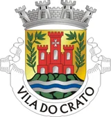
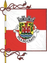
Coat of arms: CC BY-SA 3.0, Wikimedia Commons · Flag: CC BY-SA 3.0, Wikimedia Commons. Coats of arms and flags are shown for identification only; this site is not affiliated with any public authority.
.png)
