
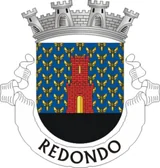

Redondo: population and statistics
Redondo has a population of 6,431 (2025) across 369.5 km², or 17.4 people per km². It ranks 229 of 308 municipalities by population. Its population is growing: +1.2% between 2021 and 2025.
- 6,431 residents
- 369.5 km²
- 17 people/km²
- 295 m
Key points
Among the 14 municipalities in Évora, Redondo ranks No. 9 by population.
Buildings built before 1946: 39.9% in Redondo, compared with an average of 22.4% in Évora and 12.5% nationally.
Usual residences with central heating: 3.7% in Redondo, compared with an average of 4.8% in Évora and 13.8% nationally.
Largest business sector: Agriculture, forestry and fishing, with 35.8% of the area's businesses.
A 1 kWp solar panel tilted at 34° generates about 1,596 kWh a year here.
Redondo in numbers
Where is Redondo?
Population of Redondo over time
Redondo had 6,352 residents in 2021 and 6,431 in 2025.
| Year | Population |
|---|---|
| 2021 | 6,352 |
| 2022 | 6,382 |
| 2023 | 6,448 |
| 2024 | 6,493 |
| 2025 | 6,431 |
Did you know?
- Number 1 in Évora for “Buildings built before 1946”.
- “Buildings built before 1946”: higher than in 99% of municipalities.
- Its area is roughly equal to 51,752 football pitches.
- Its population density is 7.1 times lower than the national average.
- The nearest municipality is Alandroal, 14.0 km away.
- The nearest more populous municipality is Estremoz (12,858 residents), 22 km away.
- A 4 kWp rooftop solar system here would generate about 6,384 kWh a year, roughly what an average household uses.
All indicators for Redondo
Value for the municipality, then the regional average and the national median (for counts: regional and national totals). The gauge places the municipality between the lowest and highest value in the country.
Population
| Indicator | Redondo | Évora | National | Position | Rank |
|---|---|---|---|---|---|
| Population aged 65 and over (2025) | 27.5% | 26.6% | 26.9% | ranked 146 of 307 | |
| Population under 15 (2025) | 12.3% | 12.1% | 11.7% | ranked 98 of 307 | |
| Ageing index (older people per 100 young people) (2025) | 224.2 | – | 229.9 | ranked 161 of 307 | |
| Population density (inhabitants per km²) (2025) | 17.4 inh./km² | – | 69.6 inh./km² | ranked 252 of 307 | |
| Population change between 2021 and 2025 (2025) | 1.24% | – | 4.50% | ranked 236 of 307 |
Housing
| Indicator | Redondo | Évora | National | Position | Rank |
|---|---|---|---|---|---|
| Buildings (2021) | 3,874 | 80,507 | 3,573,416 | ranked 257 of 308 | |
| Buildings built before 1946 (2021) | 39.9% | 22.4% | 12.8% | ranked 2 of 307 | |
| Buildings built since 2001 (2021) | 10.9% | 13.6% | 16.8% | ranked 291 of 307 | |
| Buildings in need of medium or extensive repair (2021) | 9.5% | 9.5% | 14.2% | ranked 257 of 307 | |
| Conventional family dwellings (2021) | 4,557 | 98,839 | 5,970,677 | ranked 251 of 308 | |
| Dwellings used as secondary residences (2021) | 25.4% | 18.2% | 25.8% | ranked 157 of 307 | |
| Vacant dwellings (2021) | 16.8% | 15.8% | 13.1% | ranked 68 of 307 | |
| Owner-occupied usual residences (2021) | 66.8% | 69.9% | 77.8% | ranked 281 of 307 | |
| Rented usual residences (2021) | 22.8% | 21.1% | 13.6% | ranked 40 of 307 | |
| Usual residences in buildings with 3 or more dwellings (2021) | 8.3% | 18.0% | 13.8% | ranked 218 of 307 | |
| Median selling price of housing per m² (2025) | 899 €/m² | – | 1,108 €/m² | ranked 185 of 305 |
Energy
| Indicator | Redondo | Évora | National | Position | Rank |
|---|---|---|---|---|---|
| Usual residences without heating (2021) | 16.9% | 14.3% | 18.6% | ranked 177 of 307 | |
| Usual residences with central heating (2021) | 3.7% | 4.8% | 12.6% | ranked 265 of 307 | |
| Electricity consumption per inhabitant (2024) | 3,956 kWh/inh. | 5,121 kWh/inh. | 3,690 kWh/inh. | ranked 130 of 307 |
Economy
| Indicator | Redondo | Évora | National | Position | Rank |
|---|---|---|---|---|---|
| Enterprises (2023) | 921 | 21,436 | 1,510,274 | ranked 224 of 308 | |
| Enterprises per 1,000 inhabitants (2023) | 142.8 | 133.4 | 128.1 | ranked 92 of 307 | |
| Declared gross income per inhabitant (2024) | 10,232 € | 11,967 € | 10,553 € | ranked 180 of 307 | |
| Purchasing power per capita (Portugal = 100) (2023) | 76.2 | 94.3 | 79.5 | ranked 184 of 307 |
Employment
| Indicator | Redondo | Évora | National | Position | Rank |
|---|---|---|---|---|---|
| Unemployment rate (2021) | 6.1% | 6.1% | 7.0% | ranked 204 of 307 | |
| Average monthly earnings of employees (2024) | 1,225 € | – | 1,258 € | ranked 191 of 307 |
Tourism
| Indicator | Redondo | Évora | National | Position | Rank |
|---|---|---|---|---|---|
| Overnight stays in tourist accommodation (2025) | 15,482 | 1,114,694 | 82,011,658 | ranked 232 of 307 | |
| Overnight stays per 100 inhabitants (2025) | 239.6 | 689.3 | 275.0 | ranked 175 of 306 | |
| Share of overnight stays in local accommodation (alojamento local) (2025) | 12.5% | – | 18.4% | ranked 114 of 178 |
Education
| Indicator | Redondo | Évora | National | Position | Rank |
|---|---|---|---|---|---|
| Population with completed higher education (2021) | 11.1% | 17.8% | 13.2% | ranked 220 of 307 |
Sunshine and temperatures: Redondo
Business sectors: Redondo
Share of each sector in total businesses; “×1.5” means the sector is 1.5 times more common than nationally.
- Agriculture, forestry and fishing35.8% ×4.5
- Wholesale and retail trade14.2% ×1.0
- Administrative and support services8.3% ×0.5
- Accommodation and food services7.5% ×0.9
- Construction7.2% ×1.0
- Manufacturing6.6% ×1.4
- Professional, scientific and technical5.3% ×0.5
- Health and social work3.8% ×0.5
Frequently asked questions
What is the population of Redondo?
Redondo has 6,431 residents (2025), ranking 229 of 308 municipalities.
How big is Redondo?
Redondo covers 369.5 km², with a density of 17 people per km².
Is the population of Redondo growing?
Between 2021 and 2025, the population of Redondo went from 6,352 to 6,431, a change of +1.2%.
Where is Redondo?
Redondo is in Évora. Latitude 38.646, longitude −7.546.
Buildings built before 1946: what is the figure for Redondo?
In Redondo, “Buildings built before 1946” stands at 39.9% (2021), ranking 2 of 307 municipalities; the national median is 12.8%.
Usual residences with central heating: what is the figure for Redondo?
In Redondo, “Usual residences with central heating” stands at 3.7% (2021), ranking 265 of 307 municipalities; the national median is 12.6%.
How much electricity does a solar panel produce in Redondo?
In Redondo, a 1 kWp south-facing system tilted at 34° produces about 1,596 kWh a year.
Which municipalities border Redondo?
The nearest to Redondo are Alandroal (14 km), Vila Viçosa (15 km), Borba (19 km), Estremoz (22 km), Reguengos de Monsaraz (26 km).
Coat of arms: CC BY-SA 3.0, Wikimedia Commons · Flag: CC BY-SA 3.0, Wikimedia Commons. Coats of arms and flags are shown for identification only; this site is not affiliated with any public authority.

